Click on any photo to see a larger version
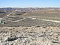 View to the west, standing in quarry A. |
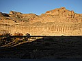
 Erosion cutting through 1000+ feet of Uinta lake deposition. This canyon is just north of our quarries. |
 Erosion cutting through 1000+ feet of Uinta lake deposition. This canyon is just north of our quarries. |
 |
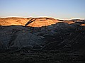
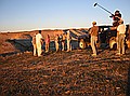 Kirk Johnson explaining the geology of the area. |
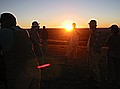 At the end of the day, Kirk Johnson explains the geology of the area and history of Lake Uinta's long 17 million year, mid Eocene life. |
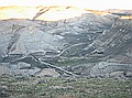
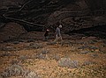 Rich and Glade searching for more rocks to roll down the hill. This is a form of sedimentary deposition not known in ancient times. |
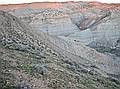
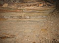 Unique sedimentary layers in the side of hill shown in previous images. Hard to tell from this image, but the upper layers actually stick out about 1 foot. |
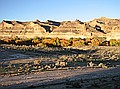
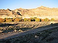
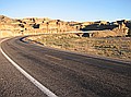
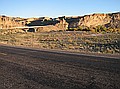
 Canyon surrounding the White River south of Bonanza, UT. |
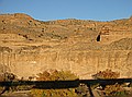 Canyon surrounding the White River south of Bonanza, UT. |
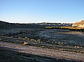 1 of 10 pictures that make panoramic image of White River canyon south of Bonanza, UT. |
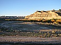 1 of 10 pictures that make panoramic image of White River canyon south of Bonanza, UT. |
 1 of 10 pictures that make panoramic image of White River canyon south of Bonanza, UT. |
 1 of 10 pictures that make panoramic image of White River canyon south of Bonanza, UT. |
 1 of 10 pictures that make panoramic image of White River canyon south of Bonanza, UT. |
 1 of 10 pictures that make panoramic image of White River canyon south of Bonanza, UT. |
 1 of 10 pictures that make panoramic image of White River canyon south of Bonanza, UT. |
 1 of 10 pictures that make panoramic image of White River canyon south of Bonanza, UT. |
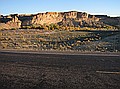 1 of 10 pictures that make panoramic image of White River canyon south of Bonanza, UT. |
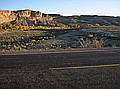 1 of 10 pictures that make panoramic image of White River canyon south of Bonanza, UT. |
Hosting donated by Wagner Database Solutions, Inc. |