
| Paleocurrents.com | Back to: |
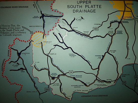
Upper South Platte River drainage system map. Of particular interest to Denver residents with the multi-year drought! Current levels as % of capacity (3/10/03) for reserviors feeding Denver are: Antero: 0.04%, 11-Mile: 45%, Cheesman: 56%, Strontia Springs: 88%, Marston: 75% (they drained upper reserviors to move water towards Denver).
Hosting donated by Wagner Database Solutions, Inc. |